

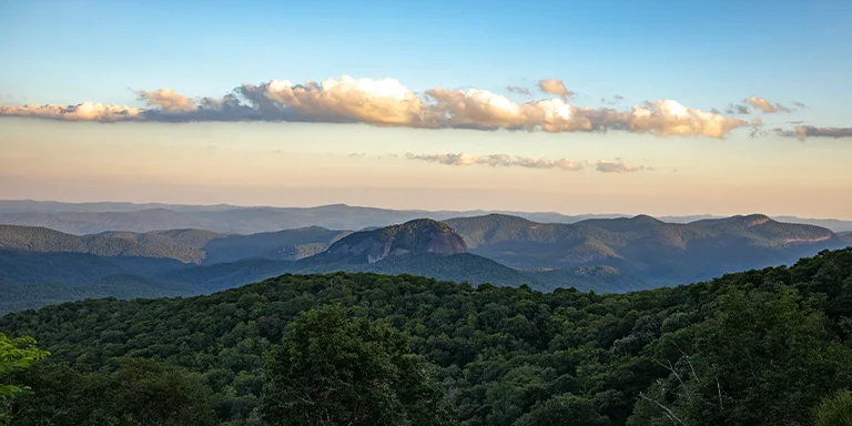
Backpacking in North Carolina offers immense variety for outdoor enthusiasts, from the storied Appalachian Mountains to windswept barrier islands, including popular destinations like the Great Smoky Mountains.
And that’s what this post is all about – backpacking in North Carolina. We’ll provide tips to help you prepare for backpacking in this diverse state as well as showcase the TOP 5 multi-day trails in North Carolina.
Interested? Let’s get started.
Discover the most stunning long trails in North Carolina for amazing adventures:
Length: 26.9 mi / 43.3 km
Type: Point to point
Difficulty: Hard
Elevation Gain: 3766 ft / 1148 m
Location: Whitewater Falls
Estimated Hiking Calorie Burn: ~3981 calories
More Details: See on AllTrails
Trek the scenic 26.9-mile Foothills Trail in western North Carolina for rewarding riverside views. This point-to-point trail from Sapphire to Whitewater Falls challenges hikers with constant elevation changes. Prepare for slippery roots and rocks along the river basin. The shaded forest keeps the humidity high even on cool days. With proper preparation for difficult navigation and varied terrain, backpackers will be awed by diverse vistas, from small waterfalls to distant mountain peaks. Solitude can be found during quieter times of day.
Length: 35.2 mi / 56.6 km
Type: Loop
Difficulty: Hard
Elevation Gain: 7539 ft / 2298 m
Location: Great Smoky Mountains National Park
Estimated Hiking Calorie Burn: ~5732 calories
More Details: See on AllTrails
Trek the challenging 35.2 mile Appalachian Trail loop in Great Smoky Mountains National Park near Bryson City, North Carolina. This popular route for backpackers immerses you in lush forest, wild creeks, and diverse ecosystems. Overnight permits and bear canisters are required. Although the well-worn path is easy to follow, be prepared with navigation skills, proper gear, and sufficient water. As there are limited mountain views, experience the Smokies by looking inward at flora and fauna. While parking fees apply, entrance to the national park remains free.

Length: 27 mi / 43.45 km
Type: Point to point
Difficulty: Hard
Elevation Gain: 5528 ft / 1685 m
Location: Nantahala National Forest
Estimated Hiking Calorie Burn: ~4346 calories
More Details: See on AllTrails
Hike the scenic yet demanding 27 mile stretch of Appalachian Trail through Great Smoky Mountains National Park near Franklin, North Carolina. This point-to-point route from Winding Stair Gap to the Nantahala Outdoor Center traverses lofty vistas atop Wayah and Wesser Balds. Prepare for steep inclines exceeding 2 miles and have navigation skills to follow white blazes. Although the well-worn path is easy to follow, challenges include length, elevation gain, and rugged terrain. Rewarding sights include diverse flora, tranquil streams, and panoramic views that make it a classic Smokies backpacking adventure. Parking fees apply but entrance to the national park remains free.
Length: 31.3 mi / 50.3 km
Type: Loop
Difficulty: Hard
Elevation Gain: 7798 ft / 2377 m
Location: Linville Gorge Wilderness
Estimated Hiking Calorie Burn: ~5316 calories
More Details: See on AllTrails
Trek the demanding 31.3 mile loop through Pisgah National Forest near Newland, North Carolina. This lesser-used trail challenges hikers with technical terrain, steep climbs, and river crossings. Early miles follow rocky, root-strewn paths with difficult navigation. Prepare for constant undulations rather than switchbacks. Bring trekking poles for stability and shoes that can get wet. This is a true backpacking route requiring vigor, attentiveness, and proper gear. Avoid in winter when frigid thigh-high river crossings increase risks. The strenuous distances and technical requirements make this a tough but rewarding adventure.
Length: 29.8 mi / 48 km
Type: Point to point
Difficulty: Hard
Elevation Gain: 8103 ft / 2470 m
Location: Pisgah National Forest
Estimated Hiking Calorie Burn: ~5197 calories
More Details: See on AllTrails
Hike the iconic yet demanding 29.8 mile Art Loeb Trail through Pisgah National Forest near Brevard, North Carolina. This point-to-point route from Davidson River to Daniel Boone Boy Scout Camp traverses high ridges with panoramic views. Prepare for challenging navigation, limited water sources, and substantial elevation changes along the rocky and root-strewn path. While the trail is heavily trafficked, particularly near Black Balsam, solitude can be found during quieter times. An optimal thru-hike is 3-4 days, allowing time to set up campsites along the way.
North Carolina’s climate varies across different regions, but in general, the state experiences a humid subtropical climate with four distinct seasons:
It’s important to check the specific weather forecast for the region you plan to backpack in, as North Carolina’s climate can vary between the mountains and the coastal areas.
Before you make your gear selection and head to the trailhead, take a look at the annual weather averages for North Carolina (Asheville):
| Jan | Feb | Mar | Apr | May | Jun | Jul | Aug | Sep | Oct | Nov | Dec | |
|---|---|---|---|---|---|---|---|---|---|---|---|---|
| High °F | 47 | 50 | 59 | 67 | 74 | 80 | 82 | 81 | 76 | 67 | 58 | 50 |
| Low °F | 29 | 31 | 38 | 45 | 53 | 61 | 64 | 63 | 57 | 46 | 37 | 32 |
| Rain/Snow (D*) | 9 | 9 | 10 | 10 | 12 | 13 | 15 | 13 | 9 | 7 | 8 | 9 |
Not sure if North Carolina is right for you?
Don’t forget to check out our backpacking guide for Tennessee.
Campfires are generally allowed while backpacking in North Carolina, but there are some restrictions to be aware of. In the forested areas of Nantahala, Pisgah, and Uwharrie National Forests, campfires are only permitted in designated campfire rings in established campsites. Backcountry campfires elsewhere require a permit from the ranger district office. There is often a seasonal ban on campfires during dry conditions.
When backpacking in North Carolina, you might come across wildlife like black bears, venomous snakes, and other animals. To stay safe, learn about the wildlife in the area from park brochures and rangers. Store food right, throw away trash, and make noise while hiking to prevent surprises with animals. If you encounter wildlife, stay calm, step back slowly, and don’t get too close. Be careful around snakes, move cautiously through bushes, and keep hands and feet away from small openings.
Embark on an outdoor adventure deep into the nature of North Carolina, but take key precautions. Before trailing through winding forests, grab a detailed trail map and make sure someone knows your plans. Pack bright clothing, first aid essentials, whistles and flashlights in case the rugged natural terrain leaves you stranded after dark. Stay on marked paths and make noise to avoid surprising bears or other wildlife. Bring plenty of water, as adventure kindles thirst. With the proper preparation, you can revel in natural wonders while backpacking across North Carolina safely. Keep your gear in order, focus on the journey ahead, and always remember that prudent planning prevents poor performance when seeking adventure in North Carolina’s magnificent wilderness.
Water sources are available but limited along backpacking trails in Oregon. Careful planning is essential to ensure adequate hydration. Natural sources like springs, streams, and lakes can be filtered for drinking but may run dry in late summer. Some trails have seasonal pumps or caches. Review water maps before hiking and fill up when possible, even if not thirsty. Carry sufficient capacity and a water treatment method like a filter or chemicals. Proper hydration is vital when exerting yourself at elevation far from civilization. With careful preparation, Oregon’s backcountry still provides ample water to experience the state’s scenic wilderness.